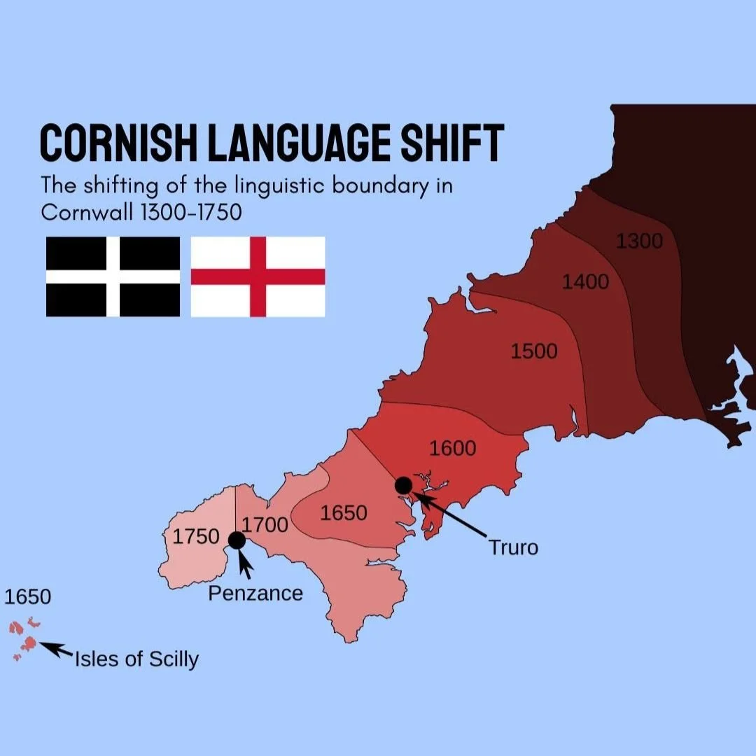
The Slow Decline of the Cornish Language
This map shows the gradual fading of the Cornish language over four and a half centuries, from 1300 to 1750.
The darker eastern sections show where Cornish first died out, while the lighter shades toward the western coast and the Isles of Scilly spotlight the last remaining sanctuaries where the native tongue held out against the spread of English.
The cartographic narrative of Cornwall between the 14th and 18th centuries is not merely a record of changing borders or shifting populations, but a visual autopsy of a dying language.
Looking at the geographic collapse of Cornish, known natively as Kernowek, the visual evidence shows a steady, systematic migration of silence.
The data reveals a linguistic frontier that consistently rolled backward from the east, where Cornwall joins the rest of England at the River Tamar, toward the jagged cliffs of the Atlantic west.
Over a span of 450 years, a vibrant Southwestern Brittonic Celtic language, which had once been spoken across the entirety of the peninsula and deep into Devon, was compressed into an ever-shrinking pocket of land before finally slipping beneath the surface of daily life.
To understand why this retreat happened along such a strict geographic gradient, one must first look at the starting point of the map in the year 1300.
At this juncture in the High Middle Ages, the darker bands on the easternmost border signify the first areas where Cornish began to lose its footing.
This eastern frontier was the most vulnerable to outside influence due to basic economics and geography.
The River Tamar was a political boundary, but it was not an impenetrable barrier to commerce, intermarriage, or administrative pressure.
As English landowners, clergy, and merchants crossed into eastern Cornwall, they brought their language with them.
In these border parishes, bilingualism quickly gave way to English dominance as the youth adopted the language of social advancement and regional trade.
By the time the map reaches the year 1400, the darker shading creeps further west, devouring the central-eastern parishes.
This period coincided with the aftermath of the Black Death and the subsequent restructuring of rural English society.
As labour became scarce, mobility increased, and the administrative machinery of the English Crown grew more centralised.
The legal courts, tax collection, and manorial records were all managed in English or Latin.

For a Cornish speaker in Bodmin or Launceston, engaging with the law or attempting to sell goods at major markets increasingly required a working knowledge of English.
The language was being systematically squeezed out of public life, relegated to the domestic hearth and the fields, which inevitably accelerated its decay among the younger generations.
The century leading up to 1500 represents a massive, tipping-point territorial shift.
As shown by the widening band of deep red cutting through the mid-section of the county, the linguistic border pushed past the historic mining districts and approached the narrow neck of the peninsula.
This era marked a profound cultural insulation of the far west. While the east was thoroughly Anglicised, the west remained fiercely traditional.
It was during this period that the miracle plays, such as the Ordinalia, were written and performed in Cornish at great open-air earthen amphitheaters known as plenys-an-gwary.
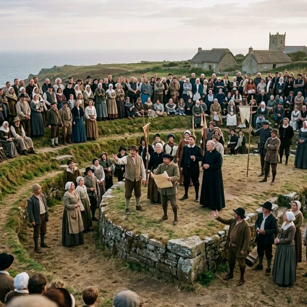
These plays were a desperate, beautiful cultural defence mechanism, serving to reinforce religious and linguistic identity in communities that could see the English language steadily marching down the road toward them.
The arrival of the year 1600 on the map marks a catastrophic acceleration of the language’s decline, driven by one of the most violent cultural shocks in Cornish history.
The mid 16th century brought the Protestant Reformation and the introduction of the 1549 Act of Uniformity, which mandated that all church services across the realm be conducted using the English Book of Common Prayer.
For the people of western Cornwall, many of whom understood no English at all, this was experienced as an act of cultural warfare.
It sparked the Prayer Book Rebellion of 1549, where thousands of Cornishmen marched east to demand the restoration of their traditional religious practices and the right to worship in a language they understood.
The rebellion was brutally crushed by foreign mercenaries employed by the Crown.
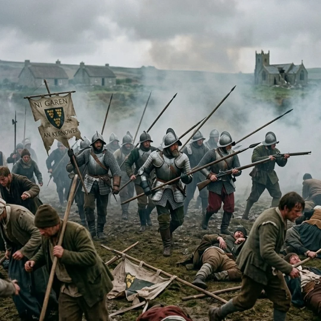
The slaughter of thousands of defenders effectively broke the back of Cornish resistance and severed the connection between the language and the institutional church.
As the map transitions into the lighter pink zones of 1650 and 1700, the language enters its twilight phase.
It was now entirely cut off from the eastern half of the county, trapped west of Truro.
By 1650, the language was primarily spoken in the fishing villages and mining hamlets of the Penwith and Kerrier hundreds, as well as on the isolated Isles of Scilly out in the Atlantic.
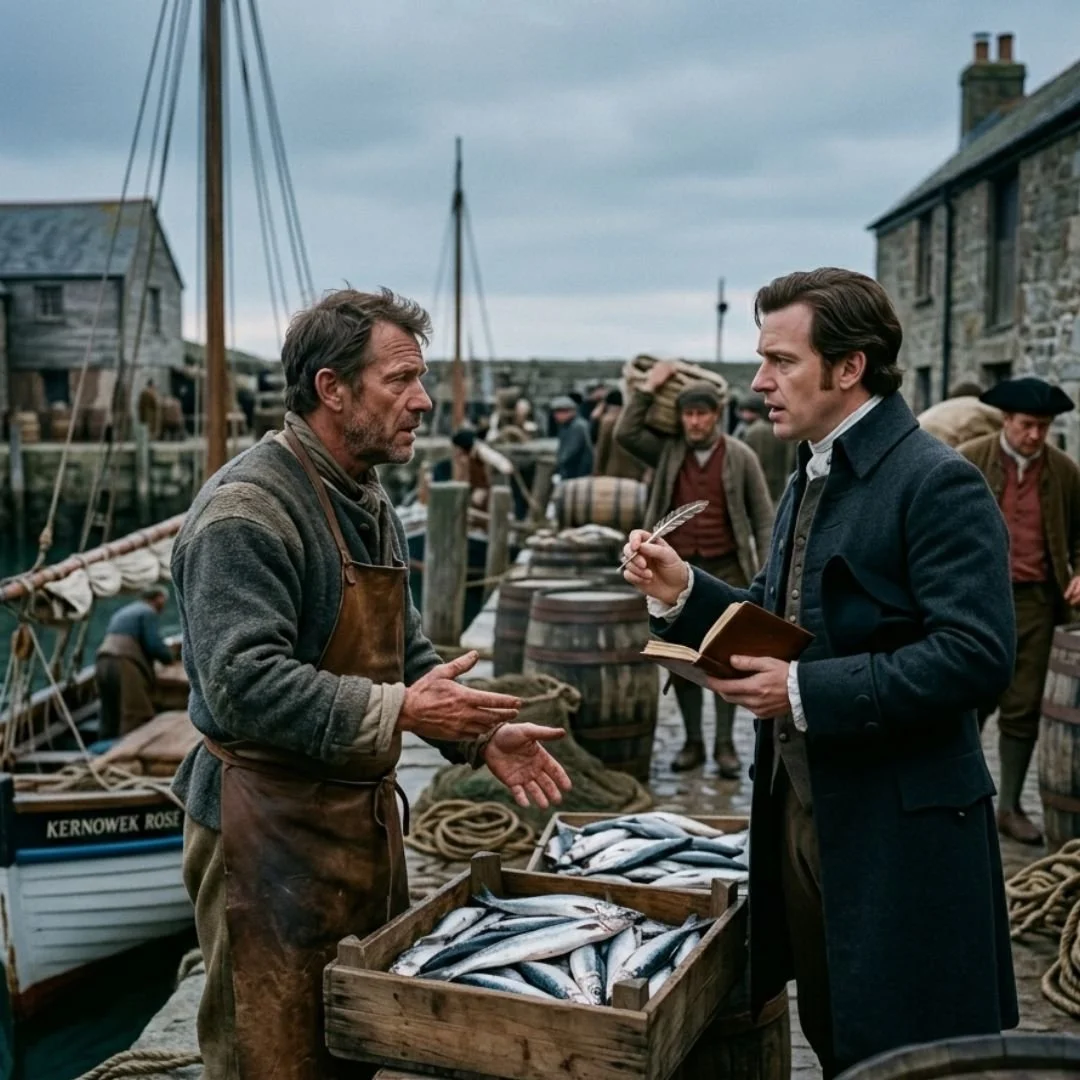
Even in these remote maritime communities, the pressures of the modern world were inescapable.
The expansion of the pilchard fishing industry and the growth of deep tin mining required extensive trade networks with Bristol and London.
Merchants in Penzance required English to conduct business, and local fishermen had to learn the tongue of the buyers who controlled the docks.
The final band of the map, dated 1750, shows the language clinging to the absolute physical limits of the land.
It was confined to the westernmost tip of the peninsula, around places like Mousehole, Paul, and St Just.
By this time, Cornish had ceased to be a language of community cohesion and had instead become an eccentric curiosity spoken by an elderly, dwindling minority.
It was during this final chapter that antiquarians like William Borlase and Daines Barrington traveled to the far west to document the speech of the last monoglot and fluent bilingual speakers, famously recording the life of Dolly Pentreath, who died in 1777 and was widely, if inaccurately, romanticized as the last native speaker of the tongue.
When looking at the map as a complete chronological sequence, it reveals that the death of Cornish was not an overnight event, but a slow, geographical starvation.
The language was pushed from the fertile river valleys of the east into the rugged, granite landscapes of the west, trapped against the sea until there was nowhere left for it to go.
The lighter shades at the tip of the peninsula and on the Isles of Scilly do not just represent the final years of a language on life support; they mark the geographical wall against which an ancient Celtic identity made its final, quiet stand before the rising tide of English completely submerged it.
If you enjoyed this blog post, please follow Exploring GB on Facebook for more!
We hope to see you back soon.