The Fosse Way: Engineering the Spine of Roman Britain
The Fosse Way is one of the most remarkable engineering feats of the Roman Empire.
Cutting a remarkably straight diagonal swath across the English landscape, this ancient highway linked the southwestern coast of Britain to the northeastern shores.
More than just a road, it was a statement of imperial control, an important artery for military deployment, and later, a corridor for trade that shaped the geography of England for millennia.
The origins of the Fosse Way are deeply intertwined with the early years of the Roman conquest of Britain, which began in AD 43 under Emperor Claudius.
As the Roman legions pushed inland from their initial landing sites, they encountered fierce resistance from various Celtic tribes.
By the late 40s AD, the Roman governor Aulus Plautius established a temporary frontier zone to consolidate control over the newly conquered lowlands before attempting to subdue the rebellious tribes of Wales and the north.
This frontier line was anchored by a massive ditch and rampart system.
The word "Fosse" itself derives from the Latin fossa, meaning ditch.
In its earliest incarnation, the Fosse Way was likely a defensive military road running just behind this protective trench, linking a chain of forts and watchtowers.
It effectively separated the Roman-controlled, civilian zone of the south and east from the hostile, untamed territories of the west and north.

As the frontier pushed further out, the defensive ditch was filled in, and the route was upgraded into a permanent, paved highway.
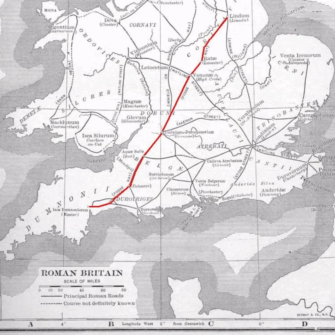
What defines the Fosse Way to the modern observer is its astonishing linearity.
Over a total distance of roughly 182 miles (293 kilometres) between Exeter (Isca Dumnoniorum) in Devon and Lincoln (Lindum Colonia) in Lincolnshire, the road never deviates more than six miles from a perfectly straight line.
This feat is even more incredible considering the varied terrain it traverses, including the rolling hills of the Cotswolds and the marshy lowlands of the Midlands.
Roman surveyors, known as gromatici, achieved this precision using simple yet effective tools like the groma to sight straight lines from one high point to the next.
Rather than winding around obstacles, Roman engineers preferred to drive straight over hills, creating a route that maximised speed and efficiency for marching legions and imperial couriers.
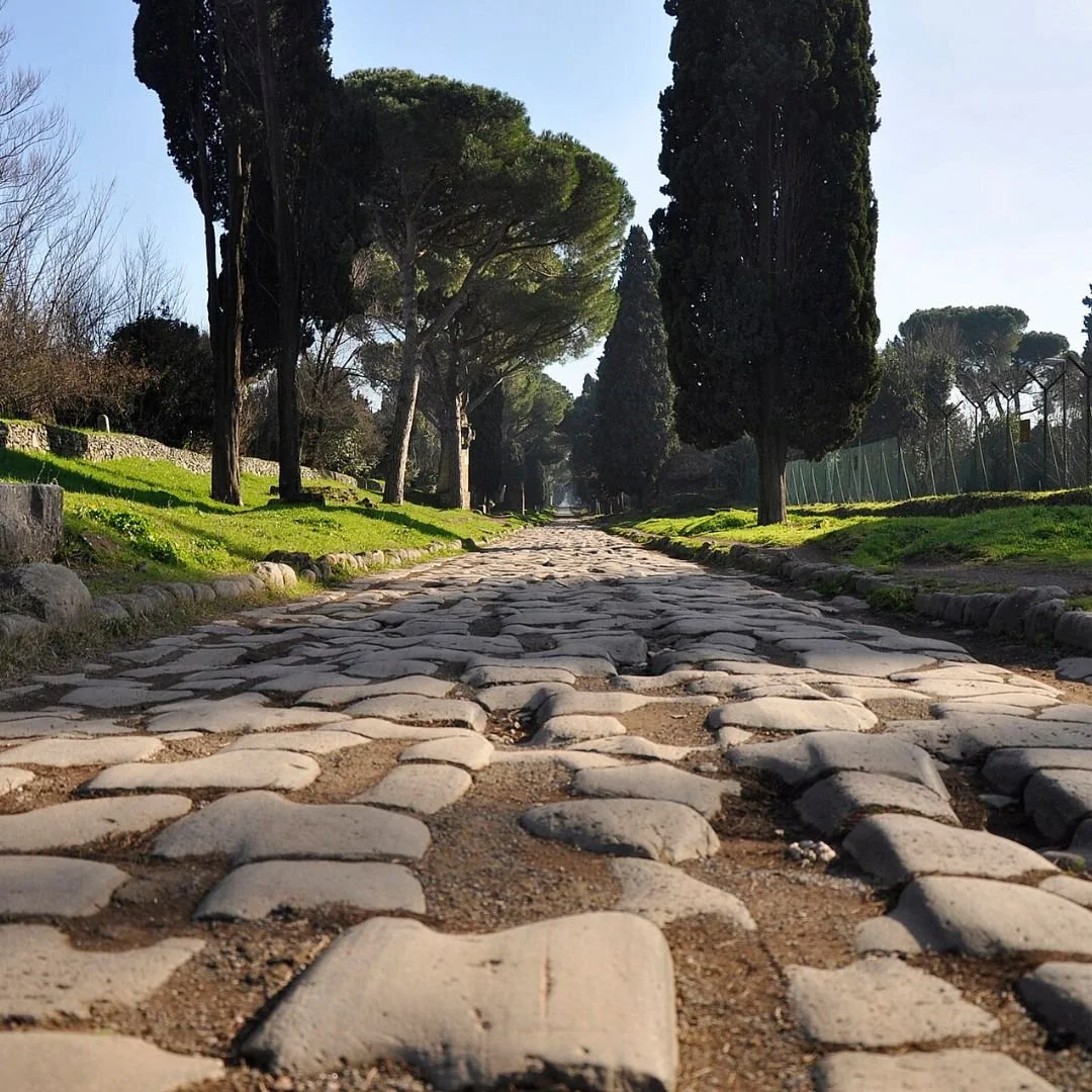
The construction of the road itself was a marvel of layered engineering designed to withstand heavy traffic and torrential British weather.
Workers would dig a wide trench, known as the fossa, down to the bedrock or solid subsoil.
This foundation was then packed with layers of large stones, followed by smaller broken stones or gravel mixed with lime mortar to create a solid, flexible base.
The surface, or summum dorsum, was paved with flat, tightly fitted local stones, slightly cambered or raised in the centre to allow rainwater to drain into flanking ditches.
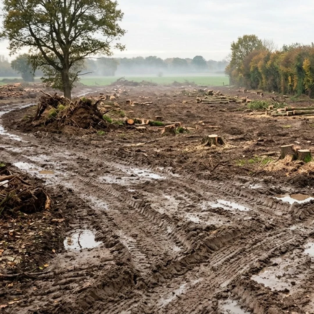
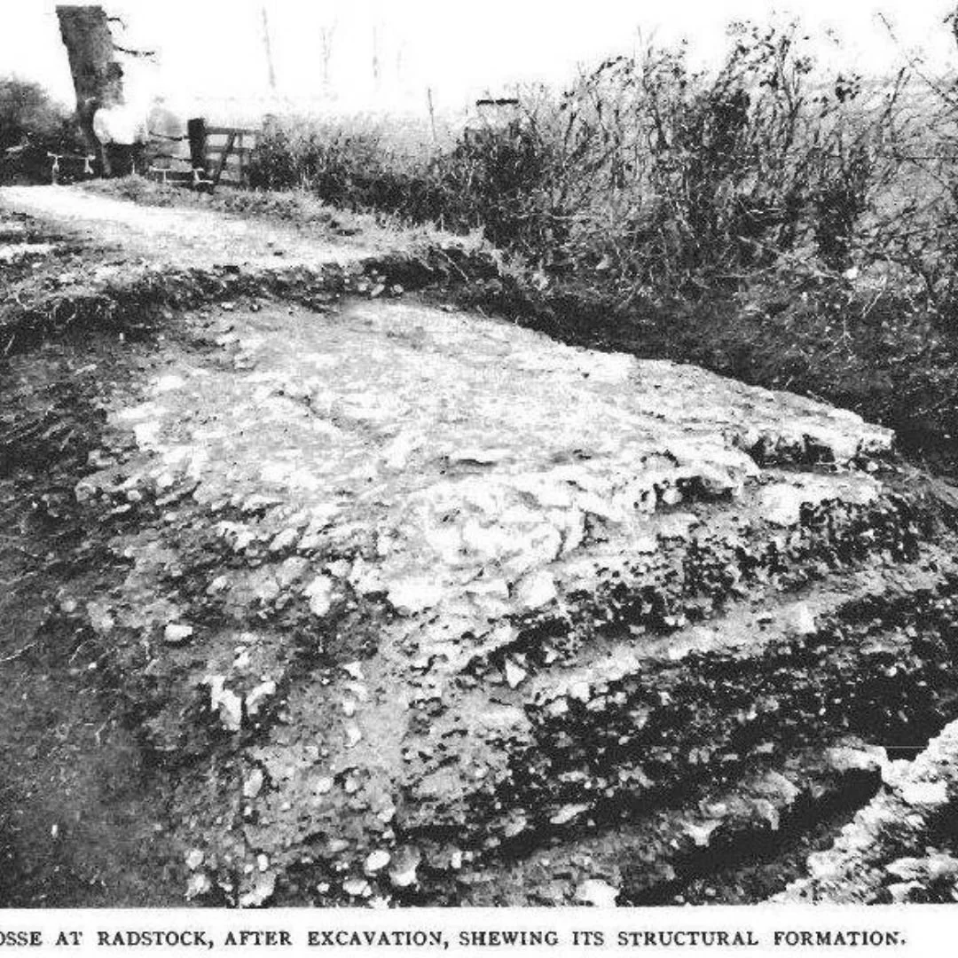
An exceptional glimpse into this rigorous construction methodology can be seen at an excavated segment of the Fosse Way at Radstock, Somerset.
Here, archeological reveals showcase the classic stratified Roman road-building technique perfectly.
The exposed cross-section displays a base of large, hand-placed kerbstones and rubble, overlaid with a compacted layer of finer gravel and a distinctly curved upper surface.
This specific section demonstrates how the Romans adapted their blueprint to utilise local Somerset stone, creating a durable highway capable of supporting heavy heavily laden wagons and marching armies for centuries without collapsing into the soft western soil.
Traveling north from its southern terminus at Exeter, the Fosse Way passed through several key Roman settlements, many of which evolved into major modern towns and cities.
From Devon, it cut through Somerset, passing through Ilchester (Lindinis), a thriving civitas capital, before reaching the grand spa town of Bath (Aquae Sulis), famed for its sacred hot springs and monumental temple complex.
Continuing northward, the road scaled the Cotswold scarp to reach Cirencester (Corinium Dobunnorum).
In the Roman era, Cirencester was the second largest city in Britain by area, surpassed only by London.
It was used as a massive commercial area, where the Fosse Way intersected with other crucial routes like Akeman Street and Ermin Street.
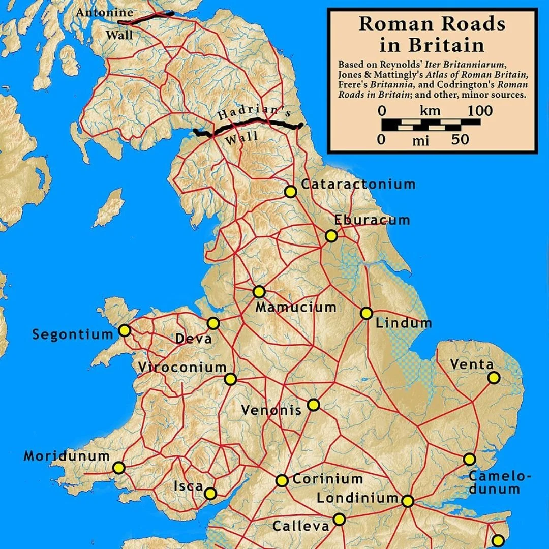
From Cirencester, the highway pushed through Gloucestershire and Warwickshire, passing through High Cross (Venonis), the geographic crossroads of Roman Britain where the Fosse Way crossed Watling Street, the great road linking London to Wales.
The route then continued through Leicester (Ratae Corieltavorum), a major tribal capital, before terminating at the legionary fortress and veteran colony of Lincoln, where it joined Ermine Street heading toward York.
As Roman authority in Britain crumbled in the early 50s AD, the formal maintenance of the Fosse Way ceased.
However, the road was too important to be abandoned.
During the Anglo-Saxon period, it was recognised as one of the Four Royal Highways protected by the King’s Peace, ensuring that travellers could use it without fear of unlawful assault.
Throughout the Middle Ages, the Fosse Way remained a crucial route for the English wool trade, linking the sheep-farming heartlands of the Cotswolds to northern markets.

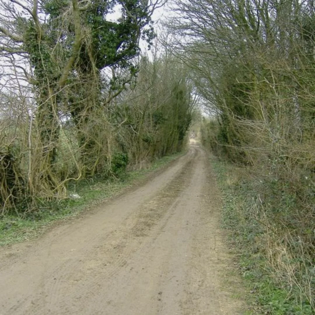
Over the centuries, sections of the road were incorporated into local turnpikes, while other, more remote segments degenerated into quiet country lanes, green lanes, or simple public footpaths.
Today, the footprint of the Fosse Way is still vividly etched into the map of England.
Large portions of the ancient route are directly overlaid by modern trunk roads, most notably the A37 in Somerset, the A429 through the Cotswolds, and the A46 between Leicester and Lincoln.
Drivers speeding along these routes are tracing the exact path laid down by Roman soldiers nearly two thousand years ago, moving along a monument of ancient engineering that continues to dictate the flow of British travel.
If you enjoyed this blog post, please follow Exploring GB on Facebook for more!