The ‘Lost’ Village of Mardale Green In The Lake District
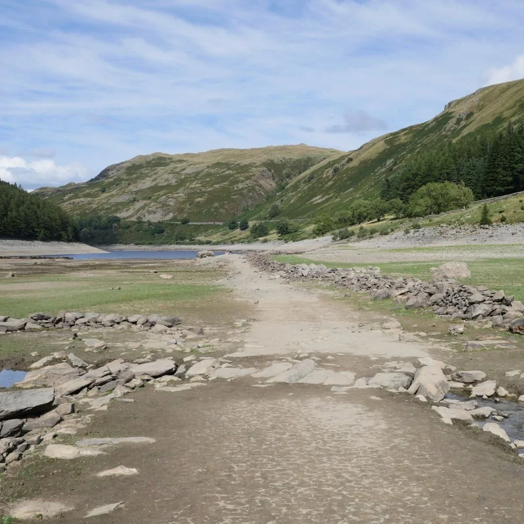
The ‘lost’ village of Mardale Green is still visible during periods of drought.
Mardale Green was located in the remote valley of Mardale, in what was historically the county of Westmorland (now Cumbria).
The valley itself had been inhabited since at least the medieval period, its fertile land and access to water making it suitable for small scale farming and pastoralism.
The earliest records of Mardale Green date back to the 17th century, though local oral traditions suggest that settlement in the valley stretches back even further, possibly to the Iron Age, when hill forts and simple agricultural communities dotted the surrounding fells.
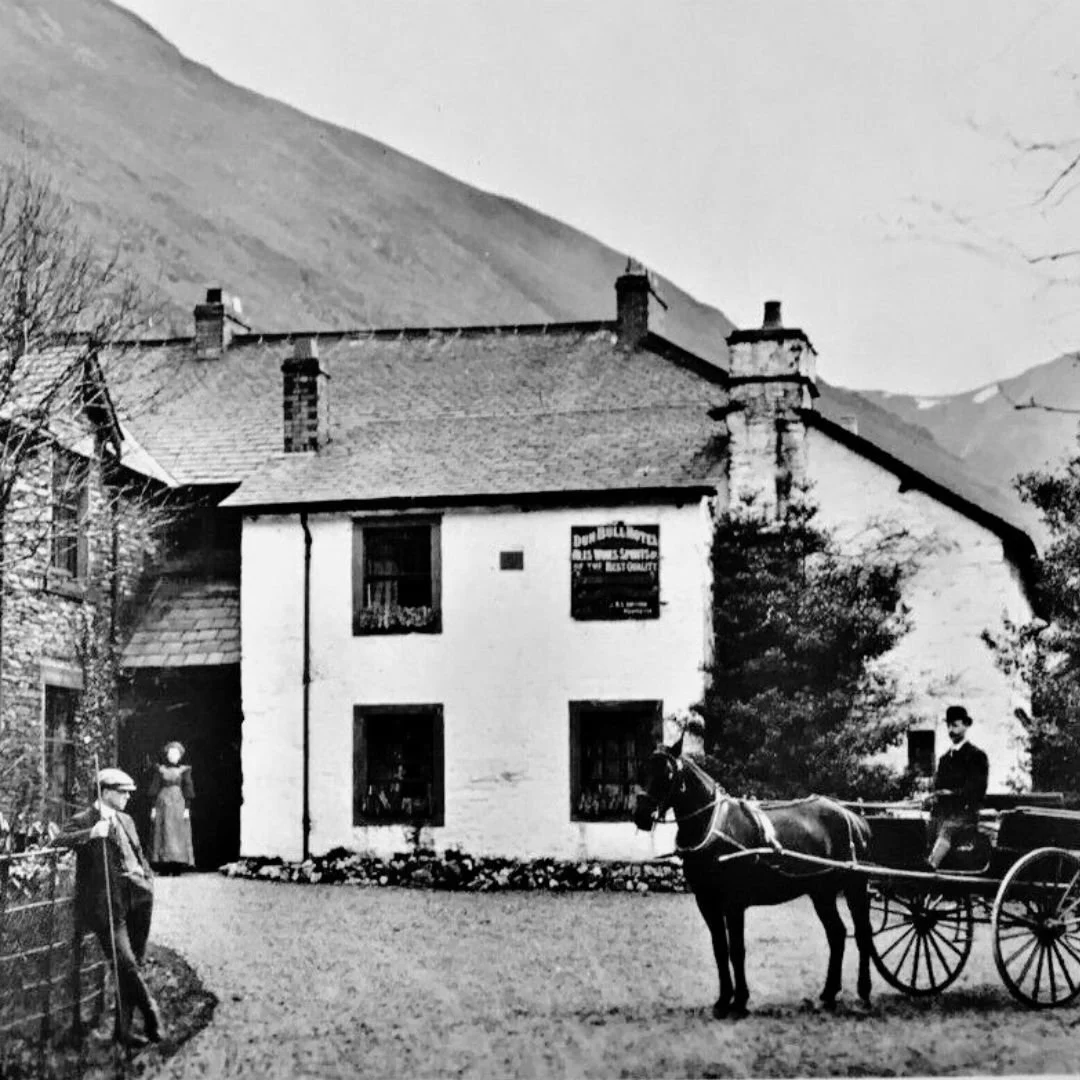
By the 19th century, it was a small but growing village.
Its population fluctuated between 70 and 120 residents, most of whom were farmers, shepherds, or associated with small-scale rural trades.
Life in the valley was harsh yet intimate: neighbours relied heavily on each other, religious gatherings at the village chapel reinforced community bonds, and festivals and fairs brought the entire valley together for moments of celebration.
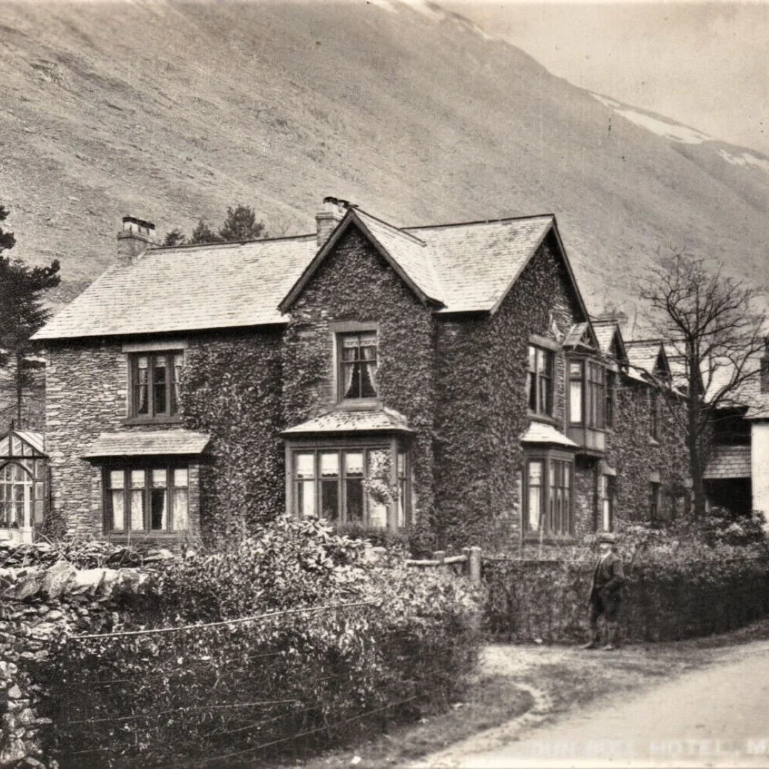
The St. Patrick’s Church of Mardale Green, built in the 18th century, was where marriages, christenings, and communal events were celebrated.
The village architecture was typically Lake District vernacular: sturdy stone cottages with slate roofs, small barns, and field walls carved out of local stone.
Many homes had adjoining small plots for crops and livestock, reflecting a community that was deeply tied to its environment.

Unfortunately, the tranquility of the beautiful village would not survive the 20th century.
As the nearby industrial city of Manchester and surrounding urban centres expanded, the demand for clean, reliable water grew dramatically.
Engineers and planners of the early 20th century scouted remote valleys across the country to construct reservoirs, often prioritising municipal need over local heritage.
The Haweswater Valley was identified as a prime location for a large reservoir due to its high rainfall, steep valley walls, and relatively isolated location.
While the valley was picturesque, the engineering assessment concluded that damming the River Mardale would provide a water source sufficient to supply millions of people.
The decision to flood the valley was controversial, but it was ultimately justified under the auspices of public necessity.

By the late 1920s, government authorities began the planning and surveying required to transform the valley into the Haweswater Reservoir.
For the residents, the announcement of the reservoir was life altering - families who had lived in the valley for generations faced the loss of not just property but identity.
The government reportedly provided compensation, but monetary settlements could not replace the deep emotional and historical ties residents had with the land.
In the early 1930s, formal eviction notices were served.
Residents were forced to relocate to nearby towns or villages. Some moved as far as Penrith or Kendal, while others left Cumbria entirely.
There are numerous recorded accounts of families dismantling their homes, taking stone by stone, or attempting to transplant beloved features like garden trees or cherished gravestones from the churchyard.
Houses were either torn down or left to decay, livestock was relocated, and the valley was prepared for submersion.
Local newspapers at the time captured the solemnity of the moment, describing the final days of a village that had, for centuries, existed in near isolation but with a rich sense of community.
Construction of the Haweswater Dam began in 1929 and was completed in 1935.
The dam, a gravity-type concrete structure, stands over 90 feet high and stretches nearly 1,200 feet across the valley.
Its creation required not just the flooding of Mardale Green but also significant alterations to the surrounding landscape, including roads, bridges, and paths that had once linked the valley to neighbouring communities.
Once the dam was completed, the waters of the Haweswater Reservoir slowly rose, swallowing fields, homes, and the old village itself.
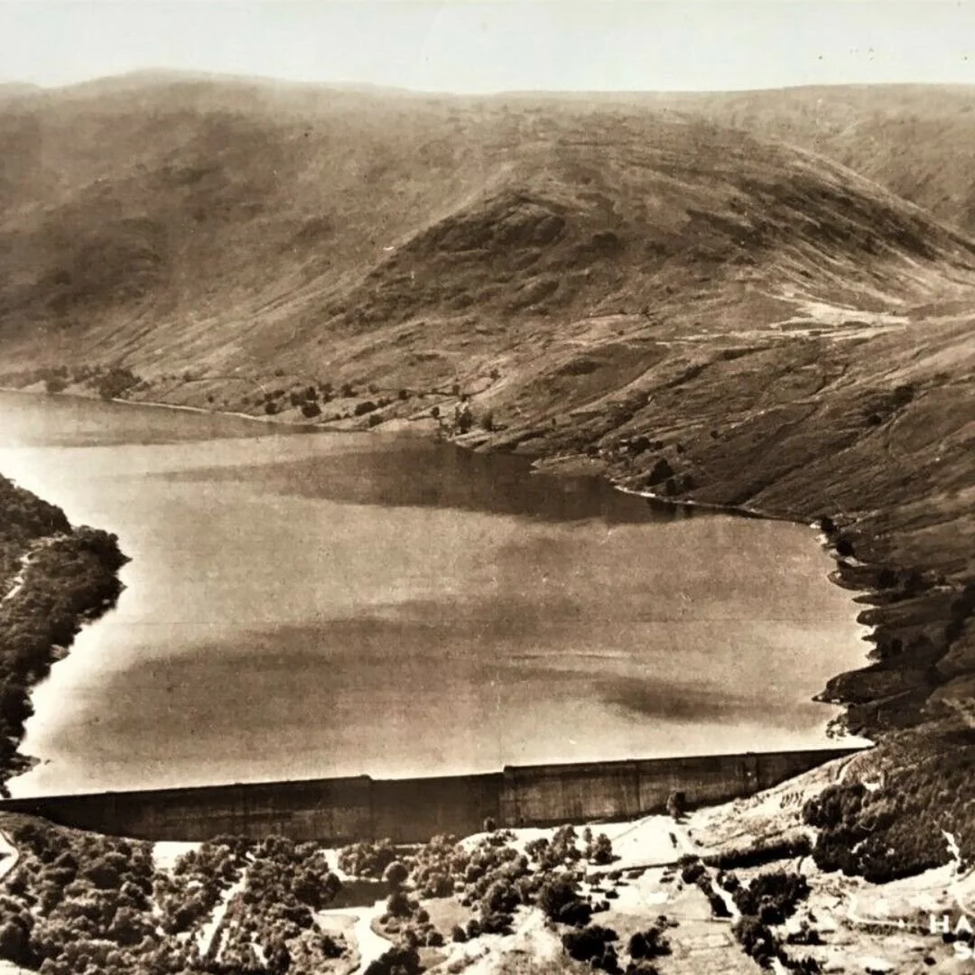
By 1936, the Green was officially submerged beneath approximately 70 feet of water.
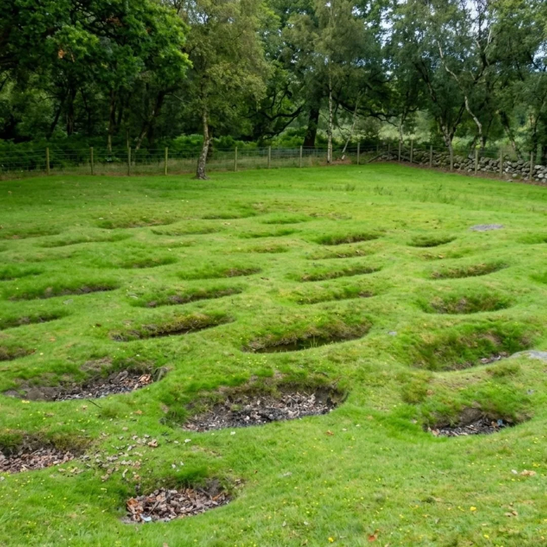
The church, cottages, and farmsteads were gone, but the outlines of the village remain to this day.
One of the most widely recorded instances was in 1976, during the UK’s severe summer drought, when foundations, walls, and even gravestones of the old village re-emerged.
Other times it has been partially visible include dry spells in 1995, 1997, 2003, and more recently in 2018, when the water level dropped enough for some ruins to peek above the reservoir’s surface.
Reacting to the news on social media, someone said: “The pompeii of the North! I was there on Friday. A bit eerie but awesome at the same time. The stories those piles of stones could tell.”
If you visit Haweswater today, the site of Mardale Green lies under the reservoir itself.

If you enjoyed this blog post, please follow Exploring GB on Facebook for daily travel content and inspiration.
Don’t forget to check out our latest blog posts below!
Thank you for visiting Exploring GB.