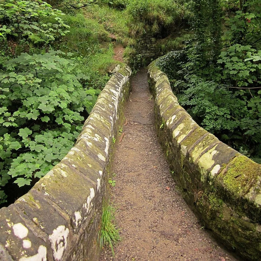
Gibraltar Packhorse Bridge In Edale, Derbyshire
The extremely narrow 'Gibraltar Bridge' in Edale, Derbyshire is thought to be the narrowest packhorse bridge in Britain.
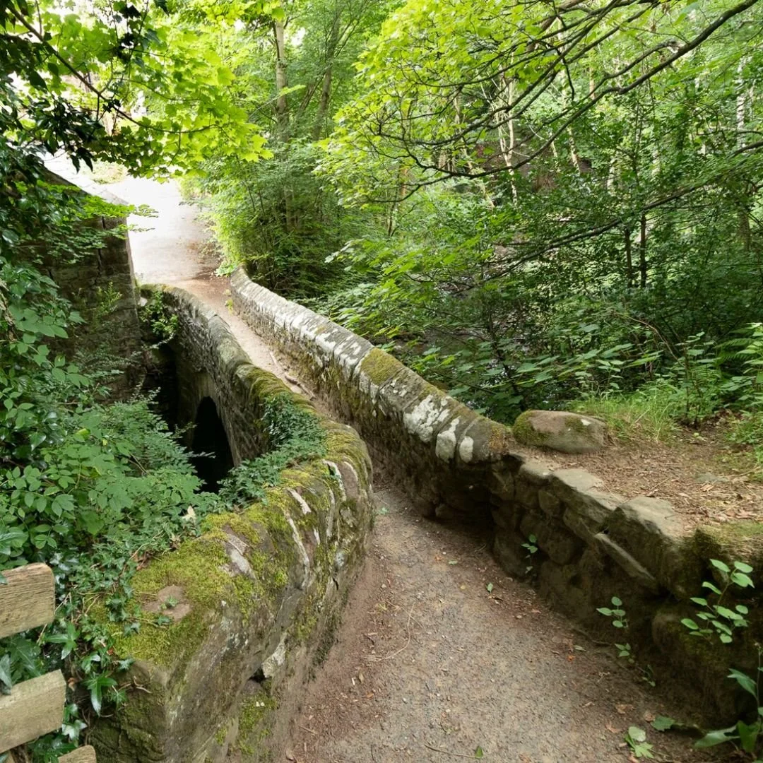
This Grade 2 listed structure, located within the picturesque Peak District National Park, dates from the 18th century.
The bridge was built just wide enough for a single animal to cross safely.
Making it any wider would have required more costly and difficult stonework, which was unnecessary at the time.
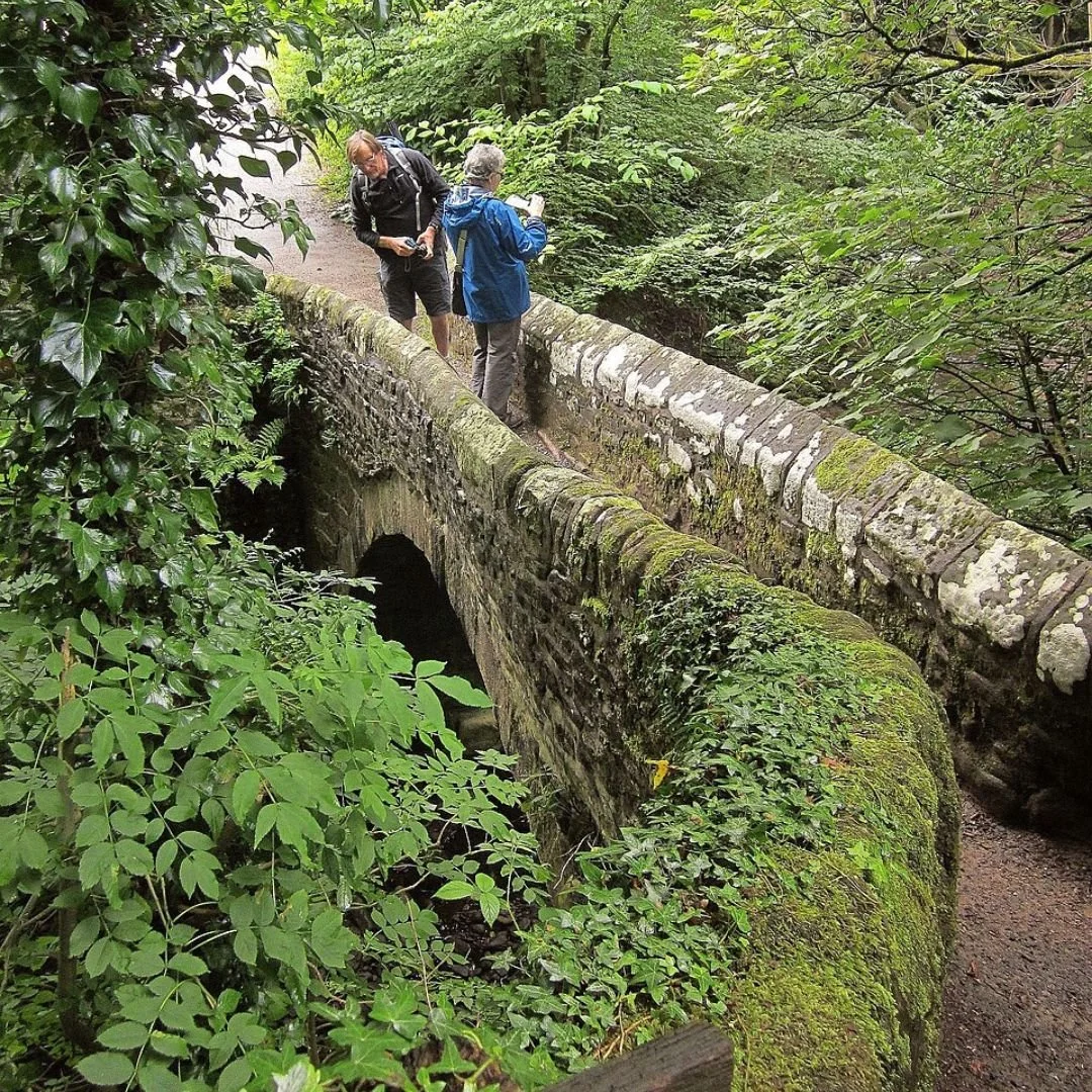
The horses’ bodies and legs were lower than the bridge parapets, so the animals could walk safely across without hitting the stone sides.
The heavy packs or panniers they carried hung higher, above the bridge walls, meaning the narrow structure didn’t get in the way of the cargo.
In essence, the bridges were built for the horses’ feet, not the height of their loads.
This clever design allowed traders to move large amounts of goods across rivers and streams efficiently, without needing wide, expensive bridges.
The narrow stone paths provided just enough space for the horse to step safely, while the overhanging packs cleared the sides.
Situated behind the Nags Head Public House, it spans Grindsbrook and connects Grindsbrook Booth to the footpath leading to Ollerbrook Booth and Nether Booth.
Recognising its historical and architectural value, Gibraltar Bridge was designated as a Grade 2 listed building in 1984.
This status ensures its protection and preservation for future generations.
It’s also recorded in the Derbyshire Historic Environment Record, underscoring its importance in the county's archaeological and historical landscape.
The route through Edale has roots stretching back to the Middle Ages, long before the stone bridge we see today was built.
In its earliest days, travellers likely crossed the river at a simple ford or used a basic wooden structure, which would have been much easier and cheaper to construct than stone.
This path was an important link across the rugged Pennines, providing a way for traders and local communities to move goods through the region despite the challenging terrain.

This route was particularly used by teams of 'jaggers' and their ponies, who specialised in transporting essential commodities such as lead, salt, wool, cotton, and cheese.
These jaggers played a vital role in the economy of the area, ensuring that local products could reach markets and that imported goods could travel inland.
Their ponies, loaded with packs on either side, were perfectly suited to the narrow and uneven tracks, which explains why bridges along the route were built so slim.
One key destination for these traders was the market at Derwent, a busy centre of commerce during this period.
The market attracted goods from across the Pennines and provided a place for local producers to sell their wares.
The jaggers would pass through Edale en route, making the village a regular waypoint on their journey.
Today, Derwent village lies beneath the waters of a reservoir.

If you’d like to visit this bridge, the address is Grindsbrook Booth, Edale, High Peak Derbyshire, S33 7ZQ.
Other nearby bridges include Jacob’s Ladder Packhorse Bridge, a 17th century gritstone structure facilitating travel from Hayfield to Edale, and Kinder Bank Packhorse Bridge, dating back to the 16th century.
If you enjoyed this blog post, please follow Exploring GB on Facebook for more!
Don’t forget to read our latest blog post below!
Thank you for visiting Exploring GB.